July 25, 2019
While waters have mostly receded, trail conditions are poor on previously reported closures.
Based on the damage caused by the comparable flood of 1993, Missouri State Parks staff expects to find scour holes, washouts, bridge damage, downed trees, debris, silt accumulation and inconsistent trail surfacing.
July 6, 2019
Mo State Parks has yet to report on the closures from the start of the month being lifted. While waters are receding, many of these stretches will require repair prior to opening to traffic.
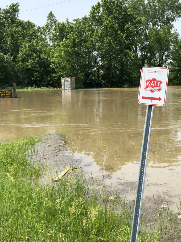
July 1, 2019
River levels rose briefly the last week of June, however, look to be falling into the 4th of July holiday weekend. This is great news as many portions of the trail in St. Charles through New Franklin have been under water more than above over the past several months. Current Katy Trail conditions are listed below. Be sure to check back as they can and will change as the month progresses.
Flood Closures:
MM 27 to MM 36, Machens Trailhead to east of St. Charles Trailhead (effective June 13)
MM 39, at Frontier Park (effective June 6)
MM 87.2 to MM 97.1, west of Treloar to just west of Case (effective May 24)
MM 110.9 to MM 163.5, Bluffton to just east of Cooper’s Landing (effective June 13)
MM 165.5 to 169.5, Providence to McBaine (effective June 29)
MM 176, between Rocheport and Huntsdale (effective June 27)
MM 178.4 to MM 180.9, west of Rocheport (effective June 5)
MM 185 to MM 188.2, east of New Franklin (effective May 23)
Exercise caution in the following areas:
MM 54.2 to MM 55, east of Weldon Spring, due to muddy conditions (effective June 14)
MM 64.0 to MM 66.2, Klondike Park to Augusta Trailhead, due to maintenance work and heavy equipment on the trail (effective June 17)
MM 163.5 to MM 178.3, Cooper’s Landing to Rocheport Trailhead, due to muddy areas (effective June 13)
MM 189.2 west of New Franklin Trailhead, due to washouts next to the bridge (effective April 18)
MM 218 west of Clifton City, due to a rock slide that blocks a portion of the trail surface
Rock Island Spur: all sections have standing water from recent rainfall (effective May 1)
Event Updates:
- Hermann Freedomfest – Continuing as planned
- Boonville – Firecracker 4X4 – Continuing as planned
- Boonville 4th of July Fireworks – Continuing as planned
- St. Charles 4th of July Riverfest – Postponed
Pingback: Katy Trail Flood Donations - Katy Trail Missouri -T Shirt - Trail Restoration
I haven’t seen this published anywhere, but the Salt Creek Bridge (approx. MM 181.5) was washed away (about 50′ from the trail) when the adjacent levee gave way some time around July 10th. This is right where US Hwy 40 crosses over the trail. So anyone traveling between Rocheport and New Franklin will have to take Hwy 240 Spur and Hwy 40 as a detour.
Pingback: Katy Trail Closures and Conditions - August 2019 - Katy Trail Missouri
Pingback: Katy Trail Closures and Conditions – Winter 2020 - Katy Trail Missouri