Updated April 5th, 2019
MM 34 – 35, east of St. Charles as well as Rocheport West of the tunnel remains closed. As a result the Boonville Do or Die Half Marathon route has been updated to a loop, starting and ending in Boonville.
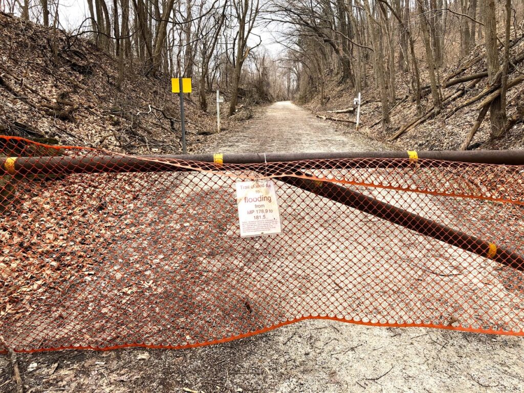
The section of trail between MM 156.8 – MM 159, near Wilton, has re-opened; trail users are encouraged to use caution due to extremely muddy patches in this section. (effective Apr. 5)
In addition, Easley River Road/Smith Hatchery Road near MM 162 is under water. While the road is under water, the trail between Route N (MM 162.5) and Little Bonne Femme Creek bridge (MM 163.6) will be opened to local vehicular traffic in this area so users need to exercise caution and expect to encounter vehicles on the trail.
Updated March 31st, 2019
The Missouri river is cresting in St. Charles and Boonville over the next 24 hours. The forecast in St. Charles has the river hitting 30.7 feet and Boonville is forecast to crest at 29.1 feet Sunday evening into Monday morning.
Mile marker 34 -35 in St. Charles is to remain closed as well as the trail just west of the tunnel in Rocheport. The St. Charles Trailhead remains dry.

March 25th, 2019
Continued snow melt and rains throughout the area have extended the flood advisory through much of the week of March 24th in St. Charles, Easley, and Rocheport.
The Missouri river in St. Charles will reach over 28 feet by Thursday, March 28th. MM 34 – 35 East of St. Charles will be impacted. Areas west such as Frontier Park and Weldon Spring are safe.

The Missouri river in Boonville will crest at 27.7 feet. Expect the trail west of the Rocheport tunnel to remain closed. The trail east of Rocheport remains open and offers some amazing views of the powerful river as it moves water, debris, and entire trees towards the Mississippi.
In addition, Easley River Road/Smith Hatchery Road near MM 162 is under water. While the road is under water, the trail between Route N (MM 162.5) and Little Bonne Femme Creek bridge (MM 163.6)
Areas to watch include Hartsburg. A change in the forecast by a few inches could result in water covering the trail between the Hartsburg depot and Route M (MM 153 – 158)
Pingback: St. Charles - The Power of the Missouri River - Katy Trail Missouri