May 20th, 2019
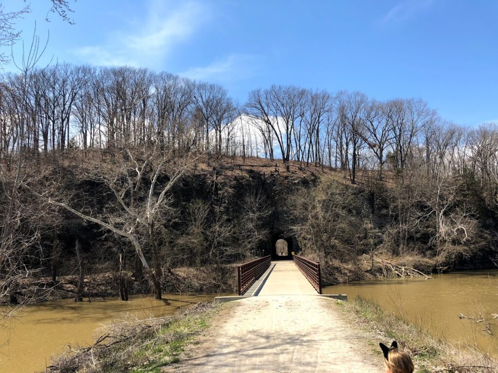
The Katy Trail is temporarily closed from MM 178.3 (Rocheport Trailhead) to MM 181.6 (Davisdale Conservation Area).
Trail users are being rerouted to Hwy. 40 and will need to exercise caution. Signs will direct trail users to follow the below detour:
- From the Rocheport Trailhead follow Katy Trail to Central Street (.2 mile).
- Turn right onto Central Street. Central Street becomes Hwy. 240 Spur (.1 mile).
- Take Hwy. 240 Spur to Hwy. 40 (1.0 mile). Turn left onto Hwy. 40.
- Take Hwy. 40 to the Davisdale Conservation Area parking lot (3.2 miles).
- Enter Katy Trail from the far side of the parking lot.
- Turn left out of the parking lot onto Katy Trail.
- From the New Franklin Trailhead, follow the Katy Trail to the Davisdale Conservation Area parking lot (6.0 miles).
- Turn right into the parking lot. Turn left onto Hwy. 40.
- Take Hwy. 40 to Hwy. 240 Spur (3.2 miles). Turn right onto Hwy. 240 Spur.
- At Rocheport, Hwy. 240 Spur becomes Central Street (.1 mile).
- Take Central Street to Katy Trail (.2 mile). Turn left onto Katy Trail.
While following the detour, trail users may experience travel over city streets and highways, motor vehicles traveling at high speeds, uneven or loose gravel on road surfaces, narrow roads and lanes.
April 15th, 2019
From Missouri State Parks:
The section of trail between MM 178.5 (Rocheport Tunnel) and approximately MM 179 will be temporarily closed beginning Mon., Apr. 15 to allow staff to rock scale around the Rocheport Tunnel. Trail users should follow detour signs posted in the area.
- From the Rocheport Trailhead follow Katy Trail to Central Street (.2 mile).
- Turn right onto Central Street. Central Street becomes Hwy. 240 Spur (.1 mile).
- Take Hwy. 240 Spur to Hwy. 40 (1.0 mile). Turn left onto Hwy. 40.
- Take Hwy. 40 to the Davisdale Conservation Area parking lot (3.2 miles).
- Enter Katy Trail from the far side of the parking lot.
- Turn left out of the parking lot onto Katy Trail.
- From the New Franklin Trailhead, follow the Katy Trail to the Davisdale Conservation Area parking lot (6.0 miles).
- Turn right into the parking lot. Turn left onto Hwy. 40.
- Take Hwy. 40 to Hwy. 240 Spur (3.2 miles). Turn right onto Hwy. 240 Spur.
- At Rocheport, Hwy. 240 Spur becomes Central Street (.1 mile).
- Take Central Street to Katy Trail (.2 mile). Turn left onto Katy Trail.
While following the detour, trail users may experience travel over city streets and highways, motor vehicles traveling at high speeds, uneven or loose gravel on road surfaces, narrow roads and lanes.
