May 28, 2019
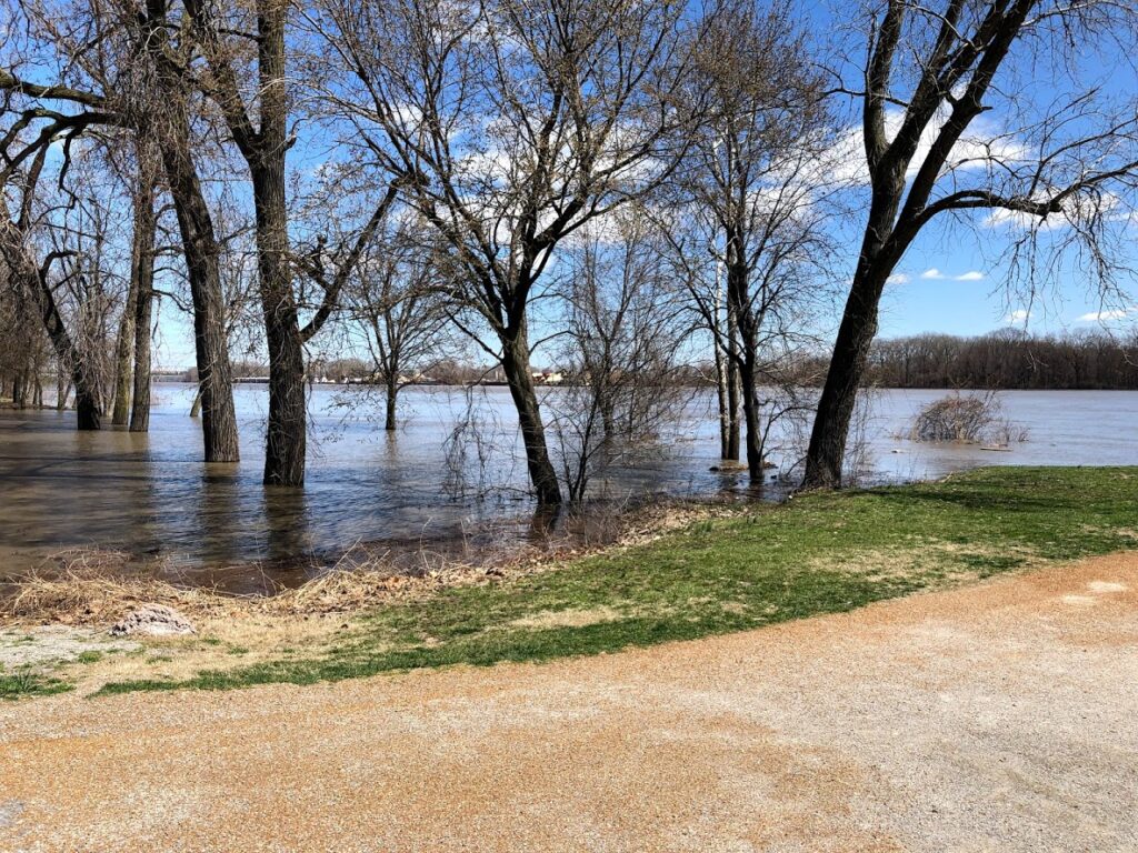
Flooding will continue along the Missouri River and Katy Trail as additional rainfall will continue to push river levels higher through the first week of June and potentially beyond.
Event Updates:
- KT82 – New Location
- Happy Feet For Healthy Minds 5K/1-Mile – Canceled
- 2019 Spirits of the Katy Bridge Wine Walk – Continuing as planned!
- 2019 Katy Trail Ride Across Missouri – Canceled
- Boonville Heritage Days – Continuing as planned!
Flood Closures:
MM 34 – 35, east of St. Charles (effective Mar. 20)
MM 115.9 – 121.4, between Portland and Steedman (effective May 3)
MM 125 – MM 180.9, between Mokane and west of Rocheport (effective May 22)
Exercise caution in the following areas:
MM 38-39: east of St. Charles, due to rough surfaces from rainfall (effective May 3)
MM 45-48: west of Greens Bottom, due to rough surfaces from rainfall (effective May 3)
MM 189.2: east of New Franklin Trailhead, due to washouts next to the bridge (effective April 18)
MM 218: west of Clifton City, due to a rock slide that blocks a portion of the trail surface
Rock Island Spur: all sections have standing water from recent rainfall (effective May 1)
May 22, 2019
Flooding continues along the Missouri River and Katy Trail. Sandbagging is occurring in Hartsburg, Rocheport, Jefferson City, among other towns along the trail.
The Pedaler’s Jamboree from Columbia to Boonville has officially been re-routed the weekend as a large portion of the trail is underwater. Riders will still arrive at Kemper Park in Boonville where all events are still scheduled to take place. The Jamboree will undoubtedly be a blast rain or shine.
The Missouri River Irish Fest in St. Charles will continue as well but will not be able to utilize Frontier Park. The Event has been moved to New Town.
The following areas currently are affected by heavy rainfall or flooding.
Flood Closures:
MM 34 – 35, east of St. Charles (effective Mar. 20)
MM 115.9 – 121.4, between Portland and Steedman (effective May 3)
MM 125 – MM 180.9, between Mokane and west of Rocheport (effective May 22)
Exercise caution in the following areas:
MM 38-39: east of St. Charles, due to rough surfaces from rainfall (effective May 3)
MM 45-48: west of Greens Bottom, due to rough surfaces from rainfall (effective May 3)
MM 189.2: east of New Franklin Trailhead, due to washouts next to the bridge (effective April 18)
MM 218: west of Clifton City, due to a rock slide that blocks a portion of the trail surface
Rock Island Spur: all sections have standing water from recent rainfall (effective May 1)
May 21, 2019
Heavy rains throughout Missouri this week will push river levels back into flood stage. The Missouri River will crest at its highest level all Spring, just under 33 feet in Boonville and a whopping 36.6 Feet in St. Charles.
Impacted areas according to Missouri State Parks:
- MM 34 – 35, east of St. Charles (effective Mar. 20)
- MM 151-152, between Claysville and Hartsburg; detour onto E. Hartsburg Bottom gravel road to get around the closed section (effective May 1)
- MM 155.6 – MM 157.8, near Wilton; trail users may detour around this closure by using the nearby gravel roadway (effective May 3)
- Easley River Road/Smith Hatchery Road near MM 162 is under water. While the road is under water, the trail between Route N (MM 162.5) and Little Bonne Femme Creek bridge (MM 163.6) will be opened to local vehicular traffic in this area so users need to exercise caution and expect to encounter vehicles on the trail.
- Rock Island Spur – all sections have standing water from recent rainfall (effective May 1)
- MM 115.9 – 121.4, between Portland and Steedman (effective May 3)
- MM 178.3 – 181.6, between Rocheport and Davisdale Conservation Area, will flood the evening of Tue., May 21 (effective May 21)
May 14, 2019
River levels continue to fall along the Missouri river which will allow for trail cleanup to occur. Expect rougher trail conditions in St. Charles and Rocheport. Additionally, all parts of the trail were under threat of flash flooding. Reports of rock near Pilot grove have come in as well as washouts near St. Charles.
May 9, 2019
The river remains below moderate flood stage in St. Charles. MM 34 – 34.7 is still at risk of flooding, however, Frontier Park is safe.
Boonville river levels are expected to climb to 27.6 feet on Saturday. This will potentially impact MM 178.9 – 181.5 between the Rocheport Tunnel and Davisdale Conservation area. Additionally, MM 153.6 – 157.9 between Hartsburg and Route M may experience flooding.
Trail conditions along previously reported impacted areas are rough. If traveling along the trail near Rocheport, St. Charles, Hartsburg, Hermann, or Easley exercise caution for both adverse trail conditions and displaced animals.
May 6, 2019
Water levels on the Missouri River have receded and no longer at moderate flood stage in St. Charles or Boonville. Stay tuned as additional rainfall (2-5 inches) is forecast this week which could push the river higher.
Trail conditions along previously reported impacted areas are rough. If traveling along the trail near Rocheport, St. Charles, Hartsburg, Hermann, or Easley exercise caution for both adverse trail conditions and displaced animals.
May 3, 2019
Katy Trail State Park is temporarily closed at the following locations due to flooding:
- MM 34 – 35, east of St. Charles (effective Mar. 20)
- MM 151-152, between Claysville and Hartsburg; detour onto E. Hartsburg Bottom gravel road to get around the closed section (effective May 1)
- MM 155.6 – MM 157.8, near Wilton; trail users may detour around this closure by using the nearby gravel roadway (effective May 3)
- Easley River Road/Smith Hatchery Road near MM 162 is under water. While the road is under water, the trail between Route N (MM 162.5) and Little Bonne Femme Creek bridge (MM 163.6) will be opened to local vehicular traffic in this area so users need to exercise caution and expect to encounter vehicles on the trail.
- Rock Island Spur – all sections have standing water from recent rainfall (effective May 1)
-
MM 115.9 – 121.4, between Portland and Steedman (effective May 3)
- Rocheport MM 178.9 – 181.5, East of the Tunnel (May 2)
Trail users should also exercise caution as flash floods throughout Missouri May have washed out parts of the trail.
Pingback: Caution Advised Near Hermann - McKittrick - Katy Trail Missouri
Pingback: Missouri River Irish Fest Location Update - Katy Trail Missouri