We have updated conditions for Winter 2020!
Get the full report here.
Updated November 14, 2019
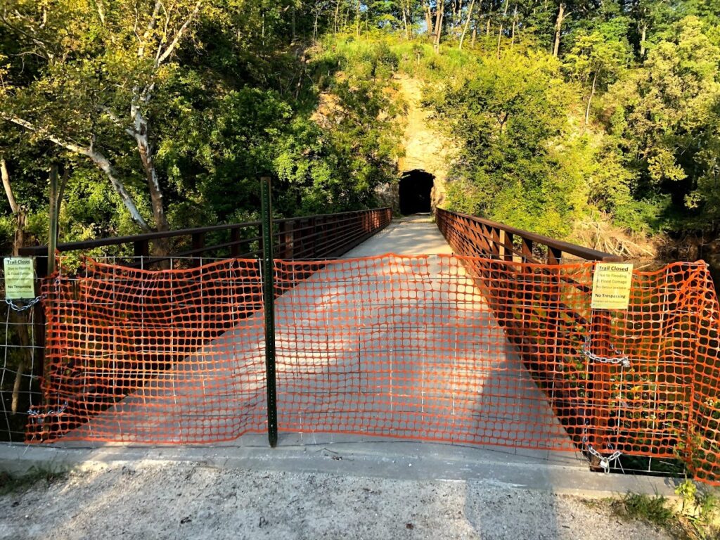
The Katy Trail has had a rough go with historic flooding shutting down large portions of the beloved limestone path. While much of the trail is open for business, those seeking to visit this fall should check conditions often as crews work to repair and replace various sections.
Temporary Closures
- MM 27 to MM 36, Machens Trailhead to east of St. Charles Trailhead (beg. 6/13/19) flooding – No recommended detour
- MM 62.6 to MM 64, west of Matson Traihead (beg. 3/4/19) bridge replacement – Detour Info
- MM 66.4 to MM 67.8, west of Augusta Trailhead (beg. 3/13/19) bridge replacement – Detour Info
- MM 96.9 to MM 97.1, at Case and slightly west (beg. 7/8/19) flooding – No recommended detour
- MM 117 to MM 118, west of Portland (beg. 8/16/19) flooding – No recommended detour
- MM 178.5 to MM 181.4, Central Street in Rocheport to Davisdale (beg. 11/1/19) – flooding – Detour Info
- East of MM 227.1, east of Sedalia Trailhead (beg. 11/14/16) alternate road route – Detour Info
- MM 264, Clinton Trailhead (beg. 9/13/19) short detour onto Highway 52 due to a roadway improvement project at Gaines Drive and Highway 52; trail users should follow signage
Exercise Caution
- MM 45.7 to MM 56, Greens Bottom Trailhead to Weldon Spring Trailhead (beg. 8/5/19) trail grading; be alert to heavy equipment and vehicles on the trail
- MM 66.3 to MM 70.5, west of August Trailhead (beg. 8/28/19) debris, slick mud, erosion and rough surface; be alert to heavy equipment and vehicles on the trail; some section may be temporarily closed during trail repair
- MM 81.2 to MM 84.7, Peers Store to Treloar Trailhead (beg. 8/28/19) debris, slick mud, erosion and rough surface; be alert to heavy equipment and vehicles on the trail; some section may be temporarily closed during trail repair
- MM 118 to MM 153.6, west of Portland to Hartsburg (beg. 8/16/19) debris, slick mud, rough surface and standing water; be alert to heavy equipment and vehicles on the trail; some sections may be temporarily closed during debris removal
- MM 157.8 to MM 162.5, west of Hartsburg to just east of Cooper’s Landing (beg. 9/19/19) extensive flood damage, uneven surfaces with sharp 2 – 6 inch rocks, slick mud and sand, quick drop and rise in trail elevation. In some areas, bicycle riders may need to carry their bicycles. Trail users are strongly recommended to use bicycles with aggressive tread. Not recommended for thin street tires. Be alert for vehicles and heavy equipment on the trail.
- MM 162.5 to MM 163.5, Easley River Road between Highway N and Cooper’s Landing (beg. 10/1/19) this area is expected to flood by Oct. 2; this section of the trail will be open to local vehicular traffic. Trail users should proceed with caution.
- MM 189.9 to MM 191.1, from County Rd 345 to Boonville Bridge (beg. 10/10/19) passable with slick mud, uneven surfaces with sharp 2 to 6 inch rocks. In some areas, bicycle riders may need to carry their bicycles.
- MM 215.5 Clifton City (beg. 7/8/19) rough surface
- MM 218 west of Clifton City (beg. 5/13/19) due to a rock slide that blocks a portion of the trail
- MM 229.9 to MM 230.9, Sedalia (beg. 9/18/19) due to heavy equipment loading rock on the trail between Mondays through Thursdays
- MM 259.3 Lewis (beg. 7/8/19) rough surface
- Rock Island Spur between Pleasant Hill and Leeton (beg. 7/8/19) rough surface, some debris
Events
- Big Bam on the Katy – 2019 – Cancelled


No recommended detour mean? No detour established or need to walk bikes on trail or need to find our own detour or just can’t bike thru at all?
This means the trail is closed and no detour has been established by Mo State Parks
Possibly planning on cycling the Katy May 2020. Has the trail been repaired?
Hi Kim! Mo State Parks is still expecting some detours in the New Franklin / Rocheport area as they repair some portions of the trail that have been washed out. No final details as of yet, however, a detour will available.
I’ve been interested in this park for some time. Due to my age, I’m not planning on walking the length of the trail, however, I am thinking about visiting each trailhead by car. I live in St. Louis, however plan starting in Clinton and working my way east. This will probably take several different excursions.
Has anyone done that and do they have any suggestions.
Thank you,
Norman Miller
Several times I have drooped folks off for bike rides and made my way home shadowing the trail as much as possible. It is scenic and enjoyable. There can be long stretches of gravel roads. Google earth and google maps are a big help. Some of the small towns have good diners or restaurants. Having a car is helpful for getting to Central Dairy in Jefferson City for ice cream.